Prepare for different weather conditions
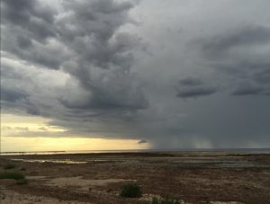
Foggy weather conditions over the Port Hughes boat ramp. A boat is launching at the boat ramp.
Checking the weather is more important than you think – Port Hughes has shown us why.
Weather conditions like fog, heavy rain, darkness and glare all have an impact on navigating safely as they restrict visibility. Sudden squalls are not easy to predict, and thunderstorms are a serious hazard for boats.
Port Hughes is a great recent example. It was a busy start to the school holidays in Port Hughes, with good reports of whiting, however recent fog over the Spencer Gulf caused some navigation hazards.
Fog isn’t uncommon this time of year. Remember, everyone on board a vessel 4.8m to 12m in length is required to wear a lifejacket during times of heightened risk. This includes during times of restricted visibility, like in the fog pictured above. And skippers, don’t forget navigation lights are also required when there is low visibility.
You can also check the times of high and low tides at the BOM website before you depart to avoid accidentally running aground. Some boat ramps are not accessible at low tide.
Boating safety starts well before you leave home
Follow these simple tips to ensure your safety before you get to the boat ramp:
- Check the weather, including any forecasted changes, via the Bureau of Meteorology (BOM) website.
- Plan your trip to decide where you will be and when you expect to return.
- Tell someone about your plans so they can keep track. Your contact should also have a plan about what to do if you don’t check in, which may include raising the alarm if you don’t return on time.
- Know what you will do and who you can contact quickly in an emergency.
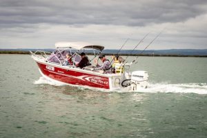
Before heading out on the water, it’s also important to know what safety equipment you need.
Personal Location Beacons (PLB) are a great piece of safety equipment to attach to your lifejacket or clothing, particularly if you are boating or paddling solo.
If you fall overboard and drift away from your vessel, activate your PLB to transmit a signal to authorities. This will help them to locate you and coordinate a rescue.
However, PLBs do not replace the requirement to carry an emergency position indicating radio beacon (EPIRB) if you are operating in waters further than 3 nautical miles from the coastline in coastal waters and 5 nautical miles from the coastline in gulf waters.
The ferries are on the move
Marine Safety Officers do more than just on-water compliance.
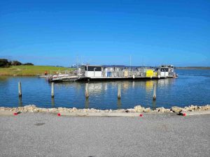
They recently assisted the Ferry Operations team in relocating several of the River Murray ferries. The process involved removing the ferries from their chains and operating the oversized barges on the open river.
The size and weight of ferries make maneuverability a challenge, especially when navigating bridges, locks and other river traffic. Many parts of the River Murray are subject to shallow water, something that has been impacted by the recent flood event.
Ferry 26, also known as Dotterel, was moved from Narrung to Goolwa. This was a long and delicate operation to move the 35-metre, 90-tonne ferry through the Marina in Goolwa and up to the slip. This ferry will undergo refurbishment to its hull, including high pressure cleaning, abrasive blasting and a protective treatment coating being applied.
Welcome to Goolwa, Dotterel!
Follow Marine Safety SA!
Earlier this month, the Marine Safety SA Facebook page reached over 1k followers!
Marine Safety SA use this page to provide updates on all things boating in South Australia, including safety tips, boat ramp and bridge opening updates, reminders about recreational boating rules and more. They also like to sneak in a quiz or two!
Marine Safety SA would like to thank their followers. If you haven’t followed them yet, visit their page.
Safety messages stick
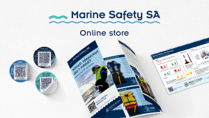
Don’t forget to head to the Marine Safety SA online store to get your boating safety stickers.
These stickers help provide quick and easy access to safety equipment checklists and Marine Safety SA online tools, so you can access the information you need when on the water.
Come visit Marine Safety SA at the field days
Each year the Marine Safety and Compliance team attend field day events to help raise awareness of boating safety and to share helpful tips with boaters.
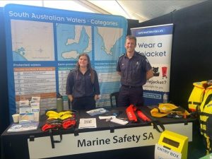
In August, the team will be visiting the Eyre Peninsula Field Days in Cleve, with more events scheduled for September at the Riverland Field Days in Barmera.
The team will be a part of the local trails at the field days (think Yellow Brick Road trail at the Royal Adelaide Show), where giveaways will be handed out to those participating.
There will also be chances to win a new lifejacket at each event!
Come and say hello. They hope to see you there and can answer all of your boating safety questions.
Do you know about Boat Code?
Unfortunately, many boats are stolen across Australia each year.
In South Australia, a compulsory Boat Code system is in place to help track and recover stolen boats, which helps to provide a level of security for registered owners.
Boat Code is a unique identification system used when:
- registering your vessel in South Australia for the first time
- applying for a change of ownership of a vessel that does not have a Hull Identification Number (HIN), or has a HIN not recorded in South Australia.
Boat Code Agents are appointed by the Department for Infrastructure and Transport, and can:
- examine vessels for signs that they have been stolen and re-birthed
- issue and verify HINs
- confirm vessel details with a written certificate.
Before going to a Boat Code Agent the boat must be registered in your name.
If you are registering your vessel for the first time in South Australia, you will receive a temporary registration certificate which is valid for 21 days. You can use your boat during this time while organising a Boat Code Agent to verify or issue a HIN.
Read the full list of Boat Code Agents in SA.
Note, it is recommend owners of boats also place locks on trailers, store their boats securely and take out insurance.
Know your speed limit – personal watercraft
Although many personal watercraft (commonly known as a jet ski) operators have put their jet skis away for the winter, there are still some that are out on the water. If you are braving the cold, please remember a four-knot speed restriction applies when you are using a jet ski within 200 metres of the shoreline along the metropolitan coast.
This includes between the Outer Harbor southern breakwater to the southern end of Sellicks Beach, and the backwaters of the River Murray (unless zoned otherwise).
Jetties are a handy guide. Most metropolitan jetties in the State are approximately 200 metre long, so are a great for a general indication of how close to shore you are.
At many popular swimming and tourist beaches, similar restrictions may apply – keep an eye out for signs.
The State’s waters are to be shared and enjoyed by everyone. Make sure you know the speed limit.


