MSQ is investing in a package of initiatives combining traditional and modern technologies to give boaties more accurate and up-to-date navigational information on how to safely cross the Wide Bay bar.
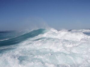
The bar, between Rainbow Beach (Inskip Point) and the southern tip of K’gari (Hook Point), has a well-deserved reputation for being unpredictable.
It is one of the most heavily trafficked of Queensland’s naturally formed coastal bars and its navigable channel shifts constantly.

It is also a notoriously treacherous stretch of water that tests the most seasoned of skippers traversing it to access offshore fishing grounds or voyage along the Queensland coast.
MSQ has worked with local stakeholders to develop solutions and collaborated with the Queensland Recreational Boating Council, in particular, over ways to provide more regular updates on the bar’s shifting sand banks.
We’ve embraced cutting edge technology, accessing satellite bathymetry to assist with hydrographic surveys to ensure the most up-to-date depth information is available.
We’re also utilising Automated Information System (AIS) technology to place virtual navigation buoys to show boaties the deepest water at any particular time.
These virtual buoys will be repositioned as changes occur. Vessels with AIS receivers and electronic charts will benefit through automatic updates of navigation data.
Meanwhile, vessels without AIS will be able to access the positions of the virtual buoys through information provided through Notices to Mariners that will allow manual plotting of the buoys.
Notices to Mariners are published online via the Queensland Government Publications Portal, with those for the Wide Bay bar hosted on the Maryborough page.
After a successful trial, the virtual buoys went ‘live’ on 30 September 2022.
They are supported by the Hook Point Light and Inskip Point Leads, both of which will be upgraded next year, and by the operations of the Tin Can Bay Coast Guard.
For more information visit www.msq.qld.gov.au


